VFR Navigation


VFR Navigation and Maps
FLYLOG navigation is loaded with following features
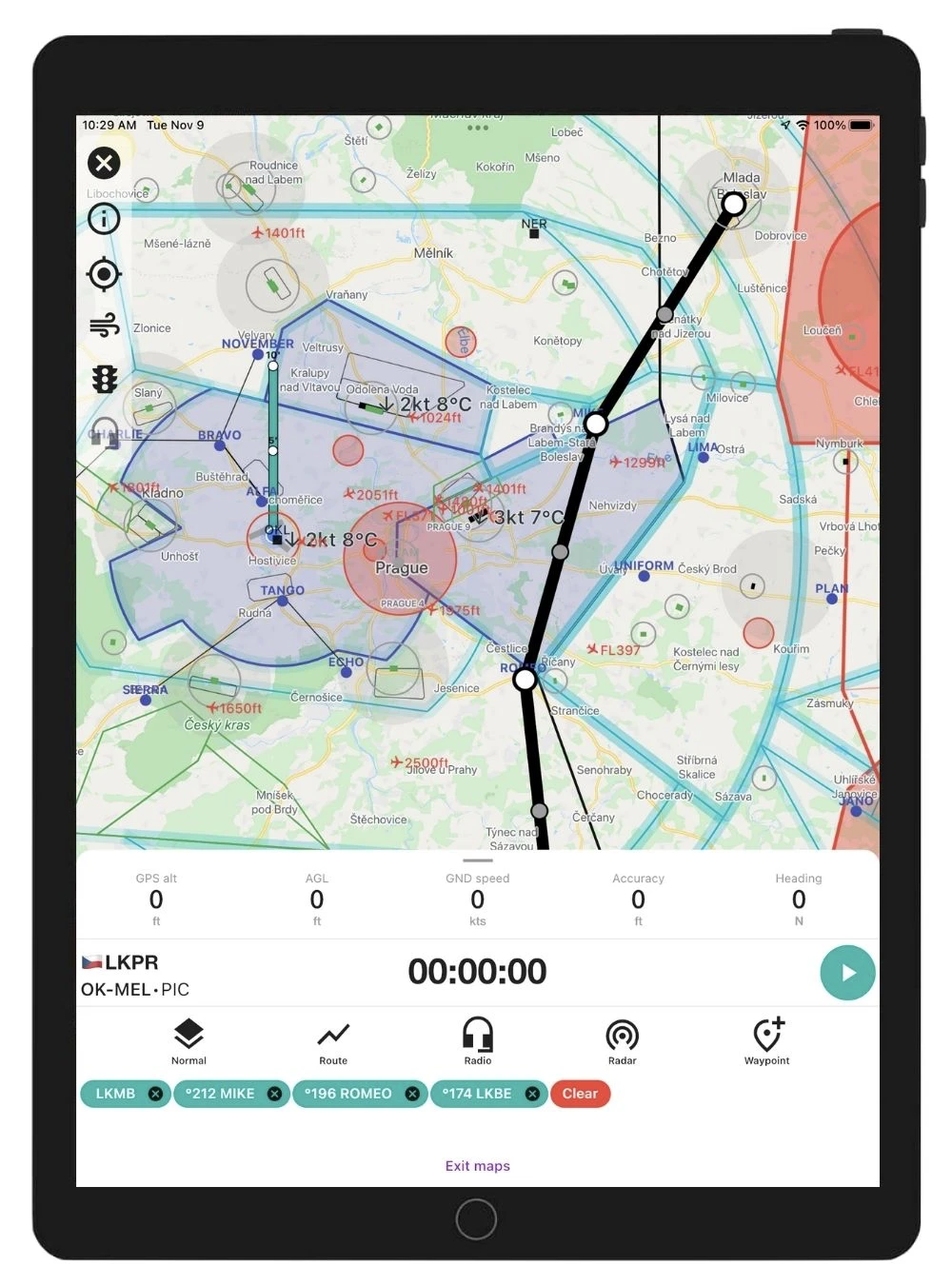
- Worldwide VFR maps
- Flight route planning
- Radio frequencies for Airports and Airspaces
- Runways
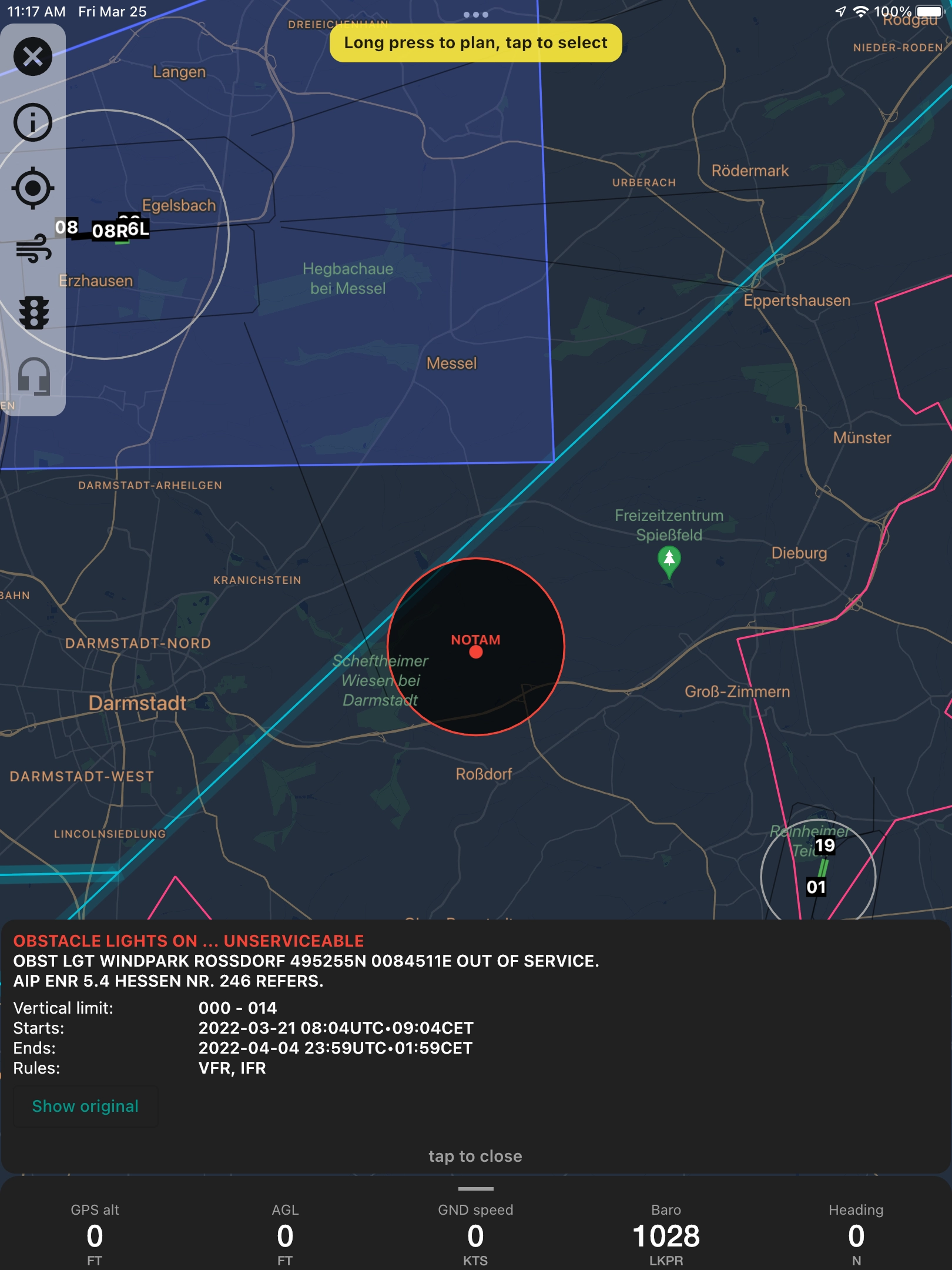
- Interactive graphical NOTAMs
- METARs
- Airspace Use Plans (AUP)
- Airport charts for selected countries
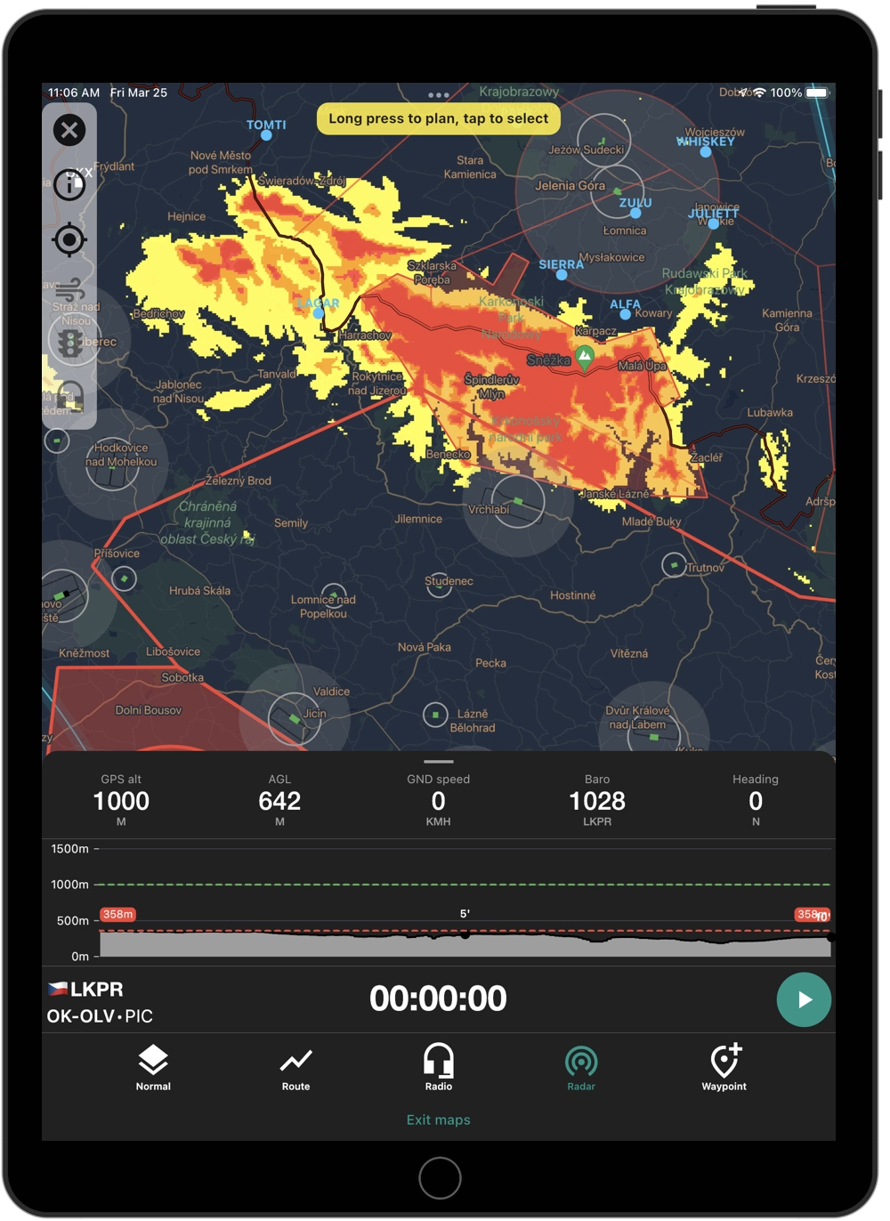
- Terrain data for virtual radar
- Above Ground Level Indicator (AGL)
FLYLOG with VFR maps is the complete solution for VFR pilots. All tools you need for your day-to-day operations in ONE application.
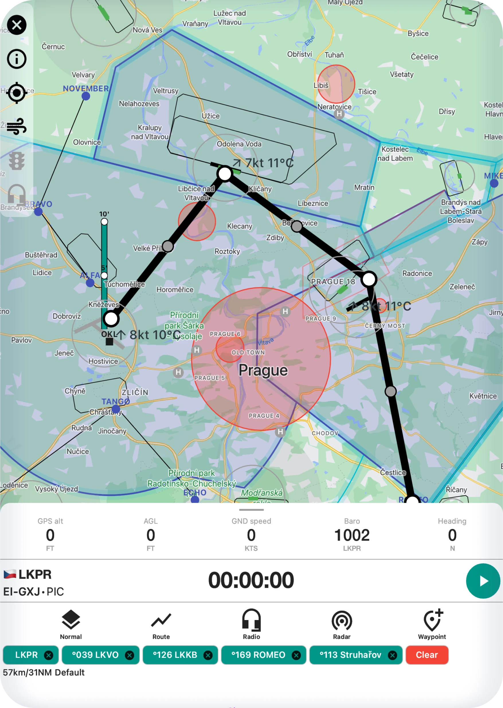
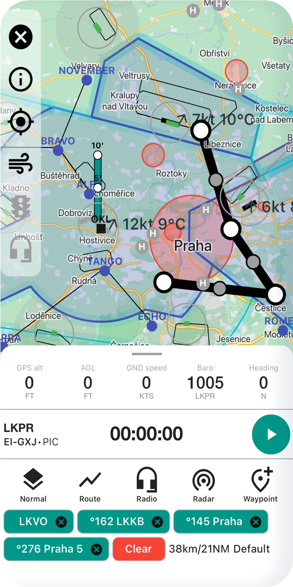
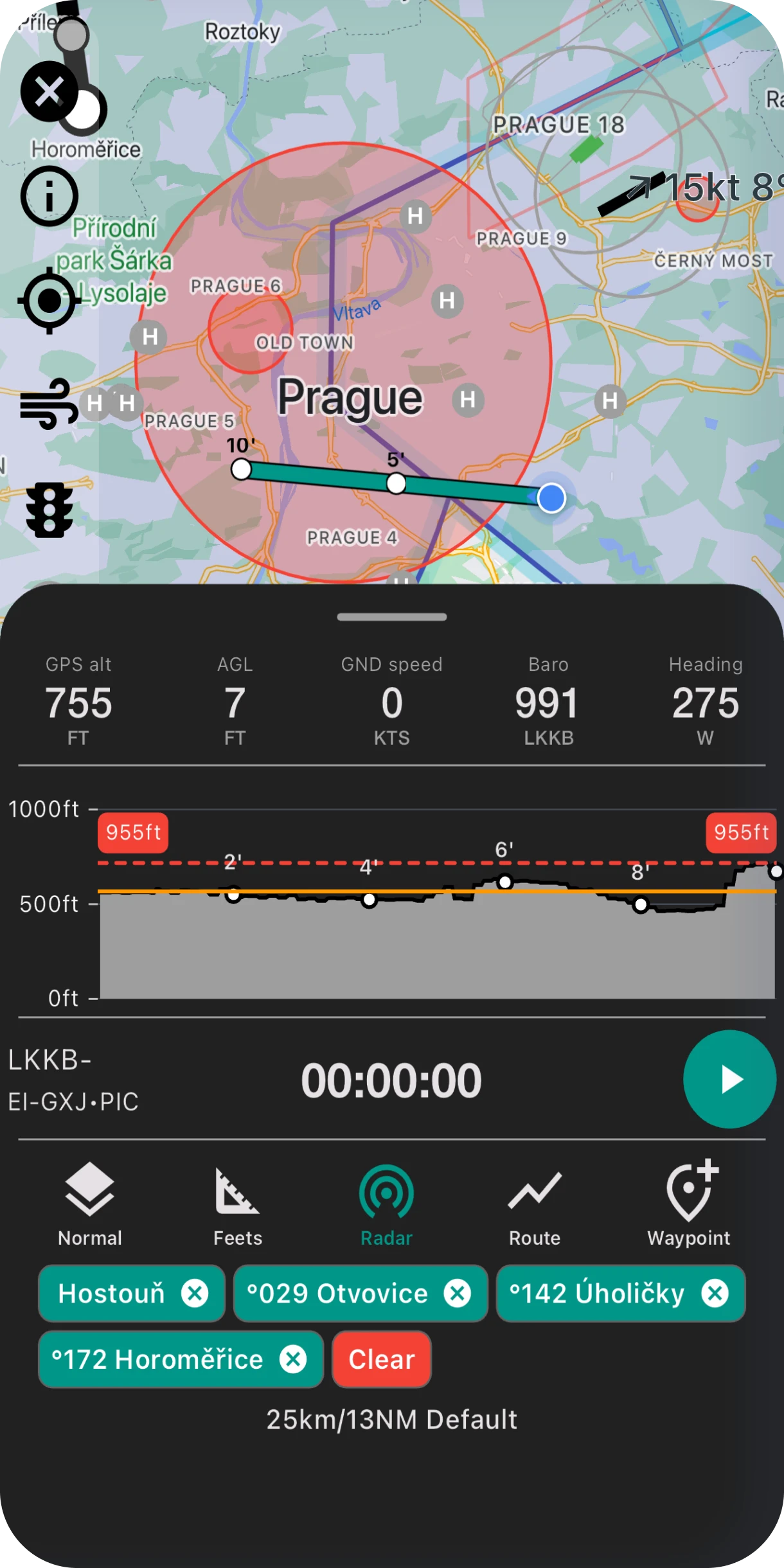
In-flight Data
Active frequencies based on your location are displayed on the screen and updated as you fly.
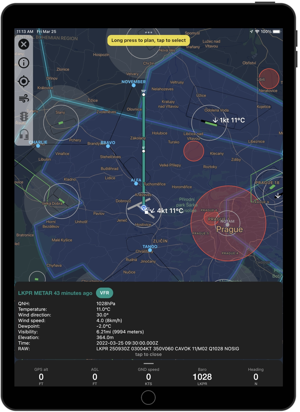
- GPS altitude,
- AGL (Above Ground Level)
- GPS speed
- BARO (Barometric pressure)
- Heading
Select your destination with long-press and ETA, and we will calculate the distance to the target.
Virtual Radar
Elevation data is available in full map overlay based on your current altitude.
Additional widget to show the terrain projection in your current vector.
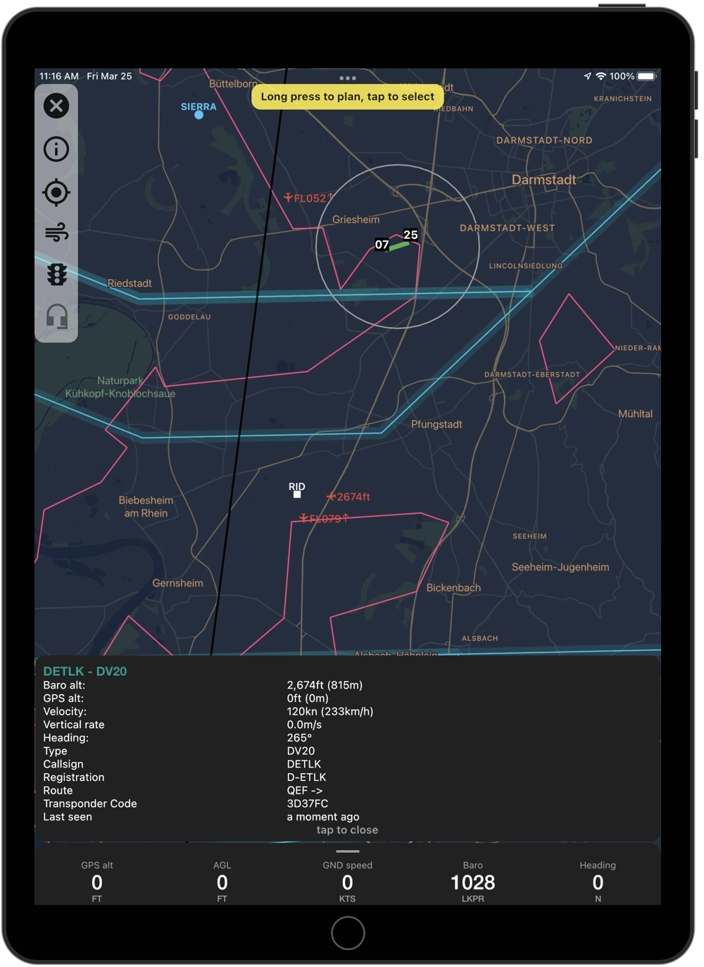
Live Traffic
Live internet traffic in your proximity is visible in real-time on your map.
METAR Messages
Worldwide METAR wheater messages available on your map with automatic refresh.
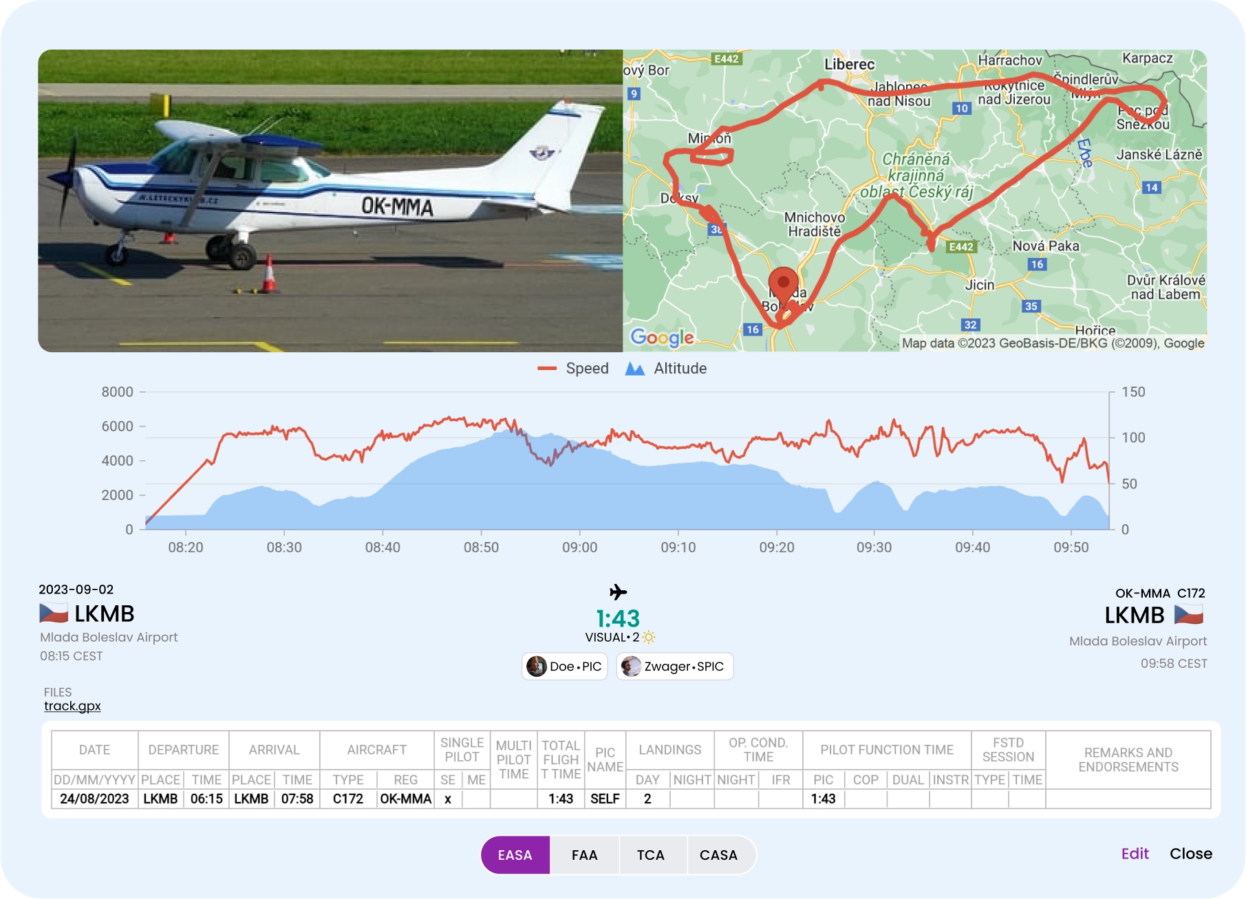
Keep Track of Flights
Press the record button in your FLYLOG mobile application and record your flight from takeoff to landing.
- Route
- Speed
- Altitude
FLYLOG automatically create a flight record with flight data in your account.