Effortless Flight Logging
Manage your data with a single platform and features that scale with your needs.
No credit card required.
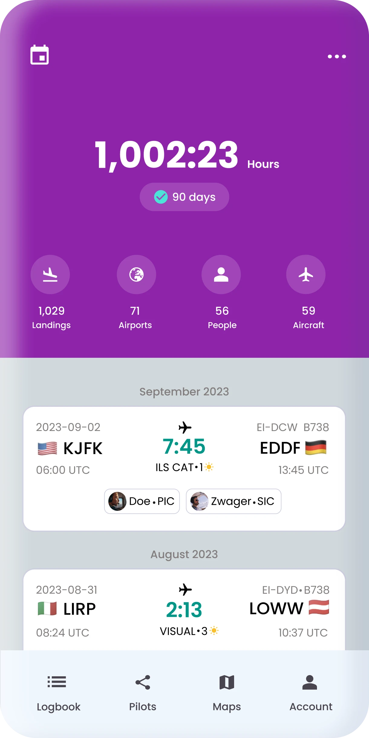
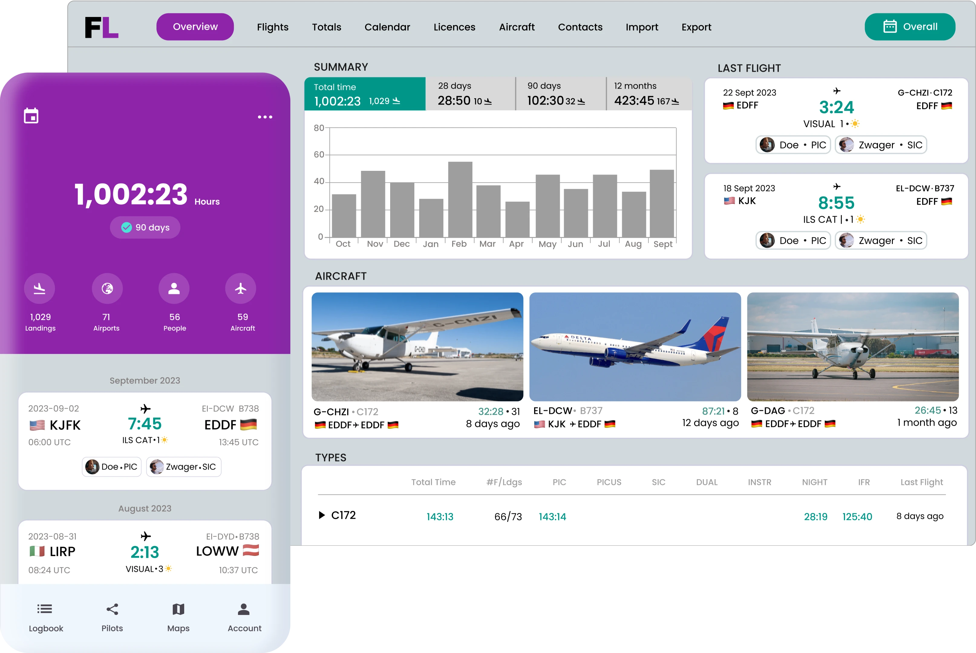
Pilot Logbook
Digital pilot logbook for pilots of all experience levels, easy to use and compliant with regulations.
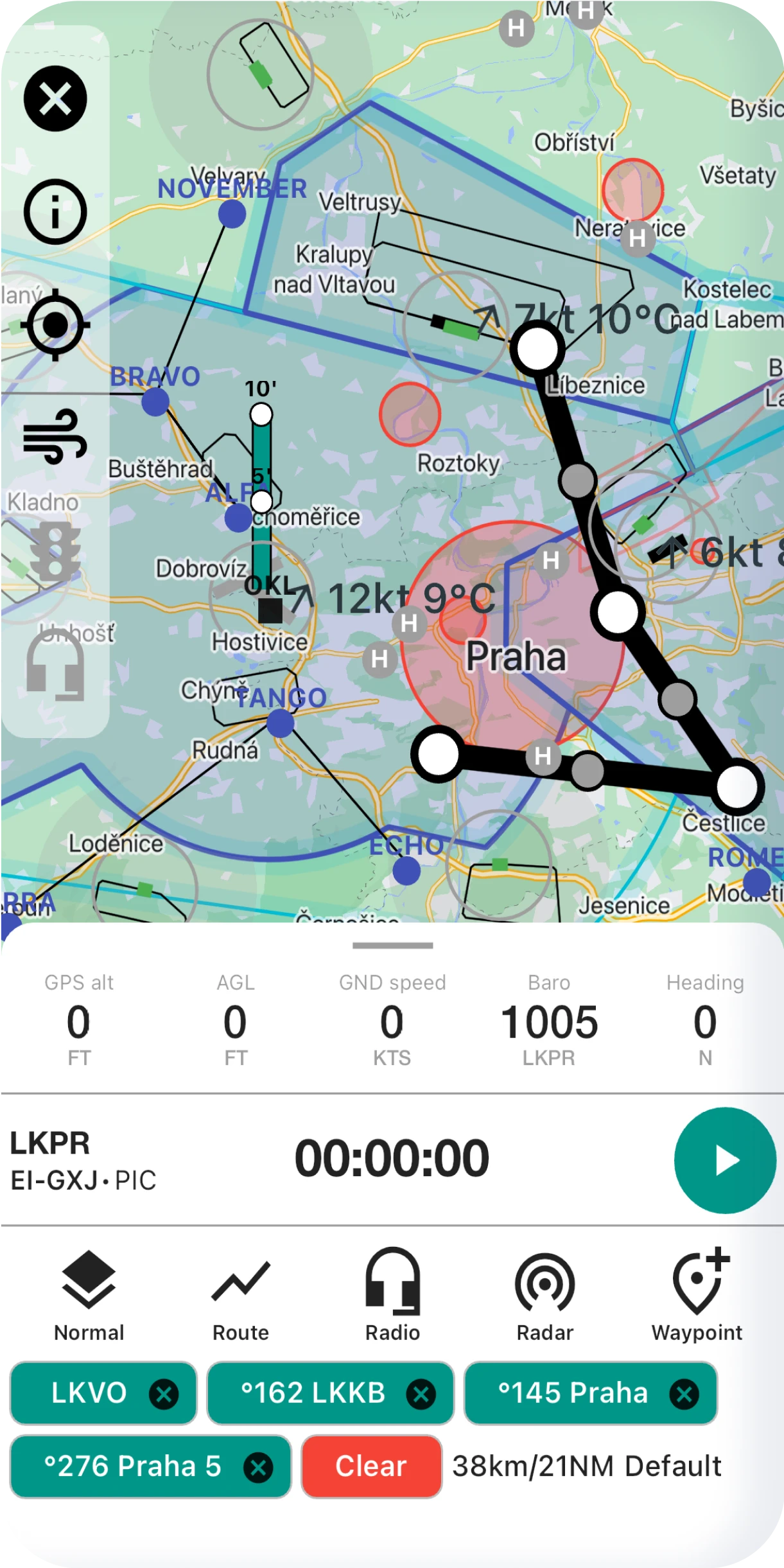
VFR Navigation
Full-featured navigation application with maps and tools for daily flight operations.
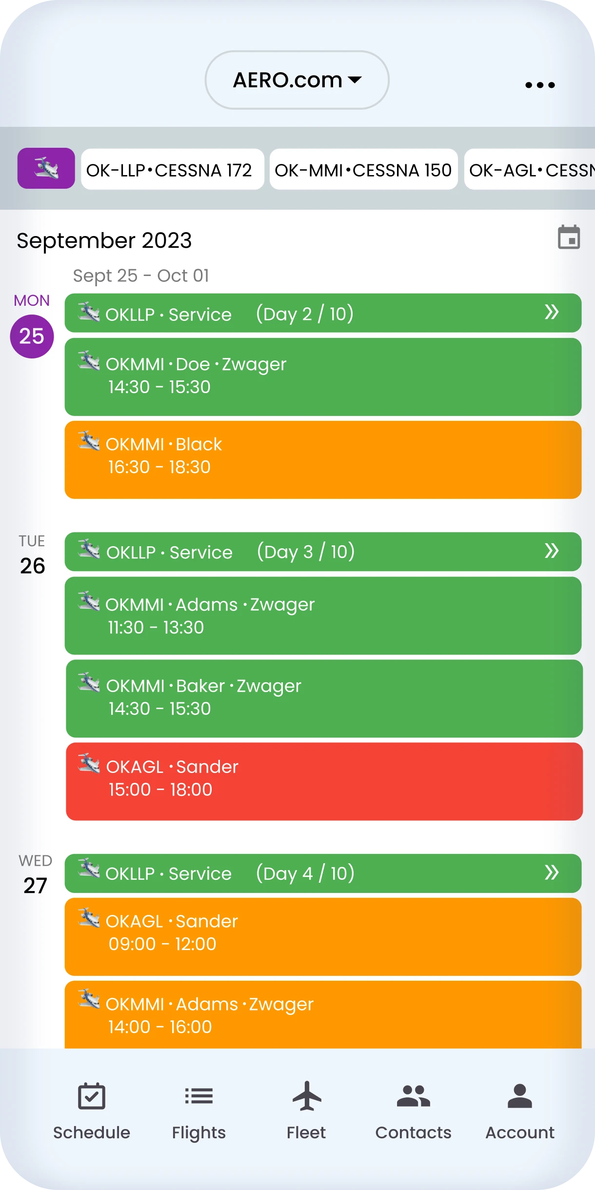
Aviation Company
The Business Platform provides an excellent management solution for Flight Schools, Rental Companies and Aircraft Owners.
Access From Anywhere, Anytime
FLYLOG.io offers web, desktop, and mobile apps so you can manage your data from anywhere even when you're offline.
Automatic syncing keeps everything up-to-date.


Available for all your devices.
Global Scale
Trusted by Pilots Around Globe

Thousands
pilots worldwide
4.8*
average rating
8 years
on the market
100+
countries represented
Plans & Pricing
A Free Trial is Available for All Plans
For Pilots
Basic
Best Pilot Logbook
€3.99
per month billed annually
$4.99 billed monthly
- Digital Pilot Logbook
- PDF Exports for Authorities
- Advanced Filters
- Night Time Calculation
- Tracker for your Licences
For Pilots
Premium
All Features Available
$7.99
per month billed annually
€8.99 billed monthly
- All Features Available
- Error Detection
- VFR Navigation & Maps
- Flight Recording
- Priority Support
For Companies
Business
Flight Schools, Rentals, Aircraft Owners
$29.00
aircraft/month
- Reservation System
- Flights & Maintenance Log
- Contact Database
- Crew Scheduling
- Billing Module
*No credit card required for trial. All prices shown do not include VAT tax if applicable
Pilot & Company Manual
This is where you'll find all the useful information you need to get to grips with the app.
