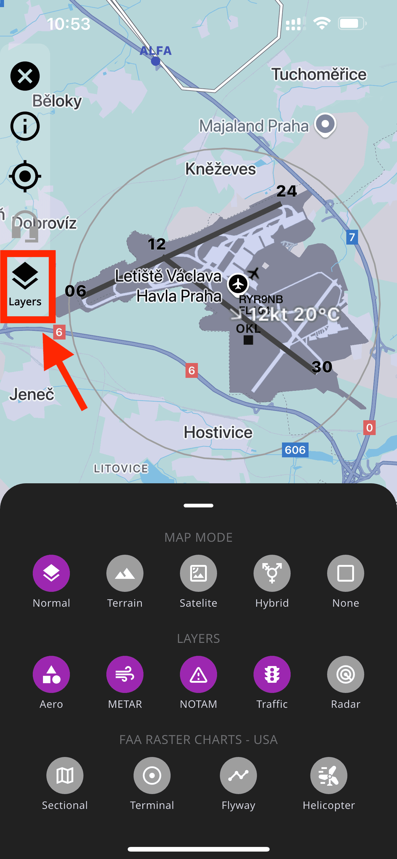
Maps & Integrated Tools
FLYLOG offers multiple map views powered by Google Maps, allowing you to tailor your navigation experience to your needs.
Map Modes
Normal – Standard map view with roads and landmarks
Satellite – High-resolution aerial imagery without labels
Terrain – Topographic map with elevation and land contours
Hybrid – Satellite imagery combined with roads and place labels
None – No base map, displaying only overlays like airspaces and airports
Integrated Map Tools
Within each map view, you have quick access to essential navigation tools, including:
METAR
NOTAM
Radar
Traffic
FAA Raster Charts
These tools are seamlessly integrated for maximum efficiency and situational awareness.
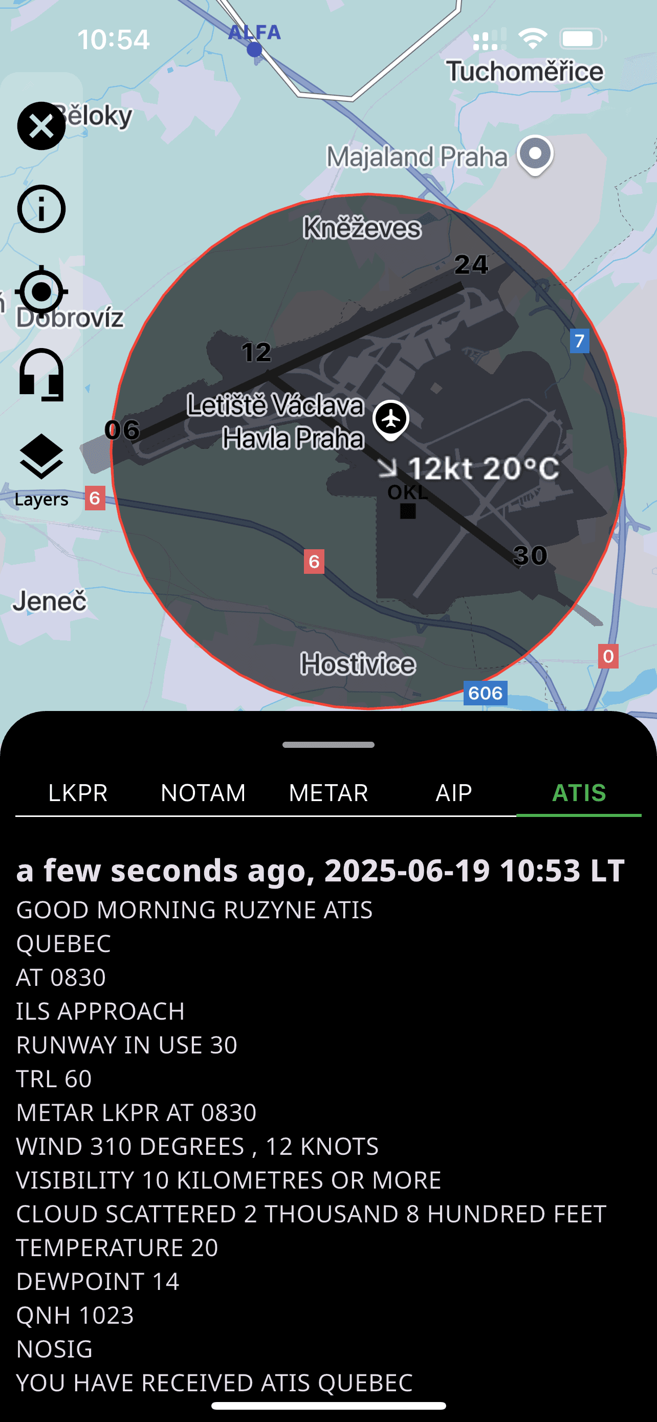
Airports and Airspaces
You can access detailed information about airports and airspaces directly from the map. Simply select an object to view details such as communication frequencies, runway layouts, and other relevant data.
⚠️ Offline Mode: To use maps offline, you must first load the desired area (e.g., a country) while connected to the internet. This downloads the necessary data. Once cached, the maps will be available for offline use without any connectivity issues.