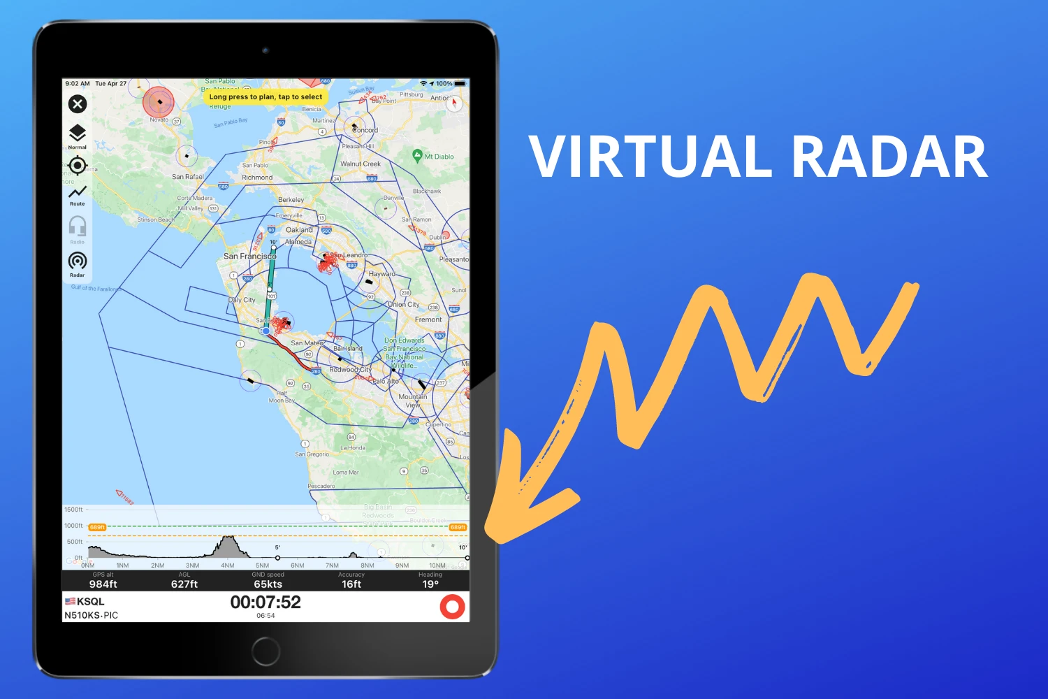
Virtual radar now available in your mobile app. FLYLOG is constantly scanning the terrain in your moving vector and the terrain profile is displayed in the overlay chart. The minimum altitude level is highlighted with orange color.
Virtual radar
Virtual radar now available in your mobile app. FLYLOG is constantly scanning the terrain in your moving vector and the terrain profile is displayed in the overlay chart. The minimum altitude level is highlighted with orange color.